
Walking in Cornwall: Best Coastal Walks in Cornwall for All Abilities
Cornwall is renowned for its stunning coastline and the South West Coast Path offers a large number of walking routes that cater to different levels of experience. Here are some of the best costal walks in Cornwall, graded by difficulty, showcasing the some of Cornwall’s stunning coastal scenery.
1. The South West Coast Path: Penzance to Mousehole (Easy)
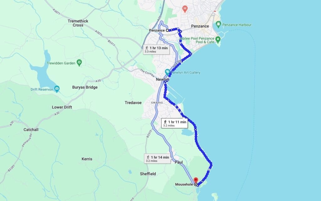
The stretch of the South West Coast Path from Penzance to Mousehole is an easy yet picturesque walk, ideal for beginners or those looking for a leisurely stroll. This 3-mile route follows the coastline, offering stunning views of Mount’s Bay and St Michael’s Mount. The path is well-maintained and mostly flat, making it accessible for families and casual walkers. As you approach Mousehole, a charming fishing village, you’ll be greeted with quaint cottages and the bustling harbour.
Google map of the route: https://maps.app.goo.gl/CGRa33azowwBC4LDA
2. Kynance Cove to Lizard Point walk (Moderate)
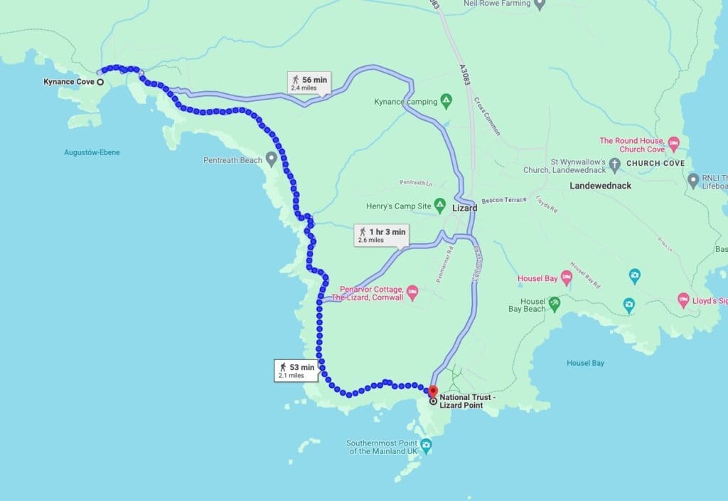
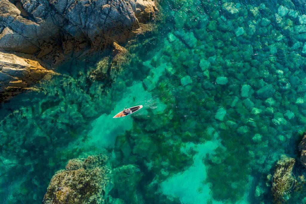
This walk along the Lizard Peninsula’s dramatic coastline is both challenging and incredibly scenic. The 7-mile route from Kynance Cove to Lizard Point, the southernmost tip of mainland Britain, offers striking views of turquoise waters and rugged cliffs. Kynance Cove is a highlight with its stunning white sand and serpentine rock formations. The path is well-marked but includes some steep ascents and descents, making it suitable for moderately experienced walkers.
Google Map of the route: https://maps.app.goo.gl/8XqEiqZJfQodsbxbA
3. St Ives to Zennor Walk (Challenging)
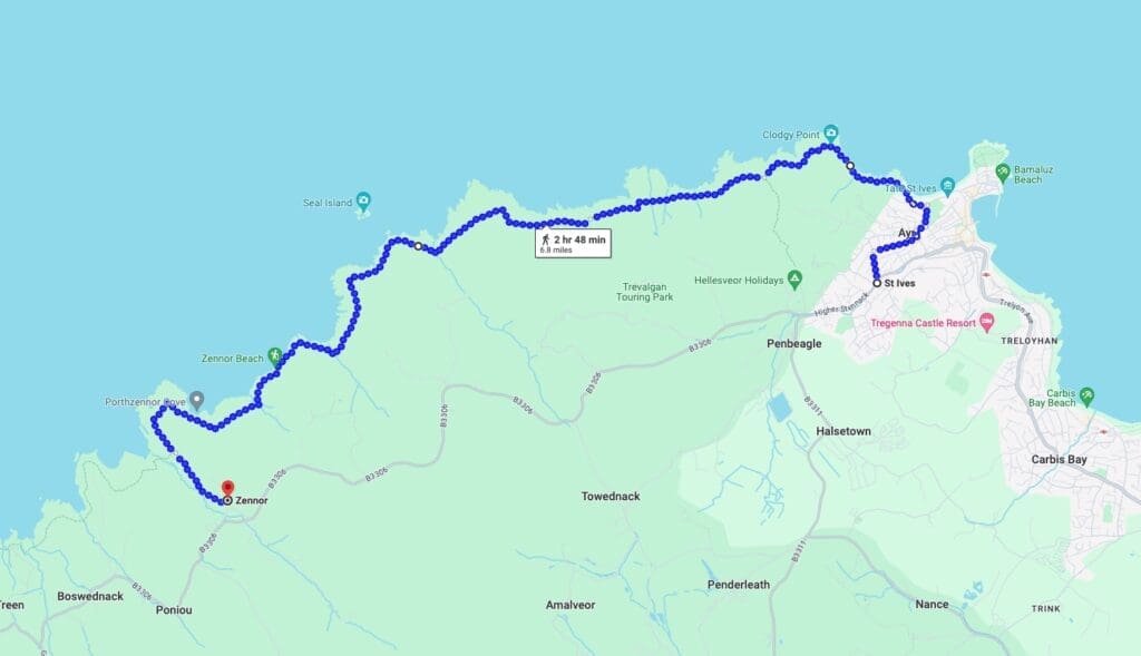
The walk from St Ives to Zennor is a stunning and challenging coastal hike along the South West Coast Path. This route covers approximately 6 miles of rugged coastline, offering breathtaking views and a sense of remote beauty. Here are detailed instructions to help you navigate this rewarding walk.
Start your journey from the picturesque harbour in St Ives. Follow the signs for the South West Coast Path, heading towards Porthmeor Beach. Pass Porthmeor Beach: Walk past the Tate St Ives gallery, keeping the beach on your right. Continue along the coast path, which is well-marked with acorn symbols.
Climb Towards Clodgy Point: The path climbs gently as you leave St Ives. You’ll pass through fields and gorse-covered areas. Clodgy Point offers your first stunning views of the Atlantic Ocean. Follow the Path to Carn Naun Point, the trail becomes more rugged as you approach Carn Naun Point. Be prepared for rocky sections and take care with your footing. Continue along the path, which can be narrow and rocky in places. This section requires careful navigation, especially in wet conditions.
Pass Treveal and Pen Enys Point: You’ll pass the remnants of old mining works and possibly spot seals in the waters below. The path undulates with some steep ascents and descents. Reaching Mussel Point the terrain here is particularly rugged, with some sections close to the cliff edge. Enjoy the dramatic views, but take care. After Mussel Point, the path heads inland slightly, crossing small streams and fields. Look out for waymarkers to ensure you’re on the right track.
As you near Zennor, you’ll pass Wicca Pool, a rocky inlet. The path becomes easier underfoot as you approach Zennor Head. The final descent into Zennor is steep but offers beautiful views of the village. Follow the path down to the village, where you’ll find the historic St. Senara’s Church and the welcoming Tinners Arms pub.
Google Map of the route: https://maps.app.goo.gl/iyr2GzqkuF9L7vhK6
4. Sennen Cove to Land’s End Walk (Moderate)
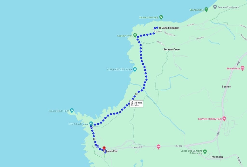
This moderate 4-mile walk from Sennen Cove to Land’s End is popular for its dramatic sea views and historical interest. Starting at Sennen Cove, park in one of the public car parks oppostite Sennen’s beautiful sandy beach, the route follows then follows the coastal path South to Land’s End, the westernmost point of mainland England. Along the way, you’ll pass by granite outrocks, the Mayon Cliff Shipwreck ancient ruins, and possibly spot seabirds and marine wildlife. The path is well-trodden but includes some uneven sections and moderate climbs.
Tintagel to Boscastle (Moderate)
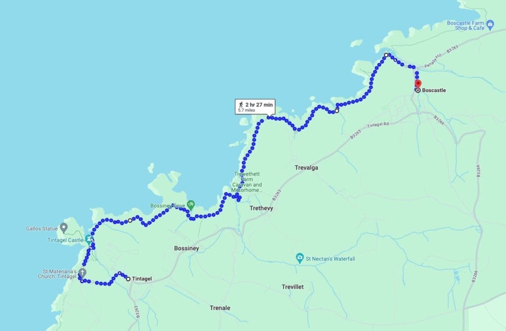
This 5-mile route from Tintagel to Boscastle along the South West Coast Path offers a mix of history and geology.
Begin at Tintagel parking in one of the public car parkes. Follow the South West Coast Path Northwards, the trail is well-marked with acorn symbols. You’ll encounter a mix of grassy paths and rocky sections.
After about 2 miles, you’ll reach Rocky Valley, a narrow gorge with ancient labyrinth carvings. This is a great spot for a short rest and some photos. Continue to Trevalga, the path continues through fields and alongside dramatic cliffs. You’ll pass through the tiny hamlet of Trevalga, where the scenery is particularly striking.
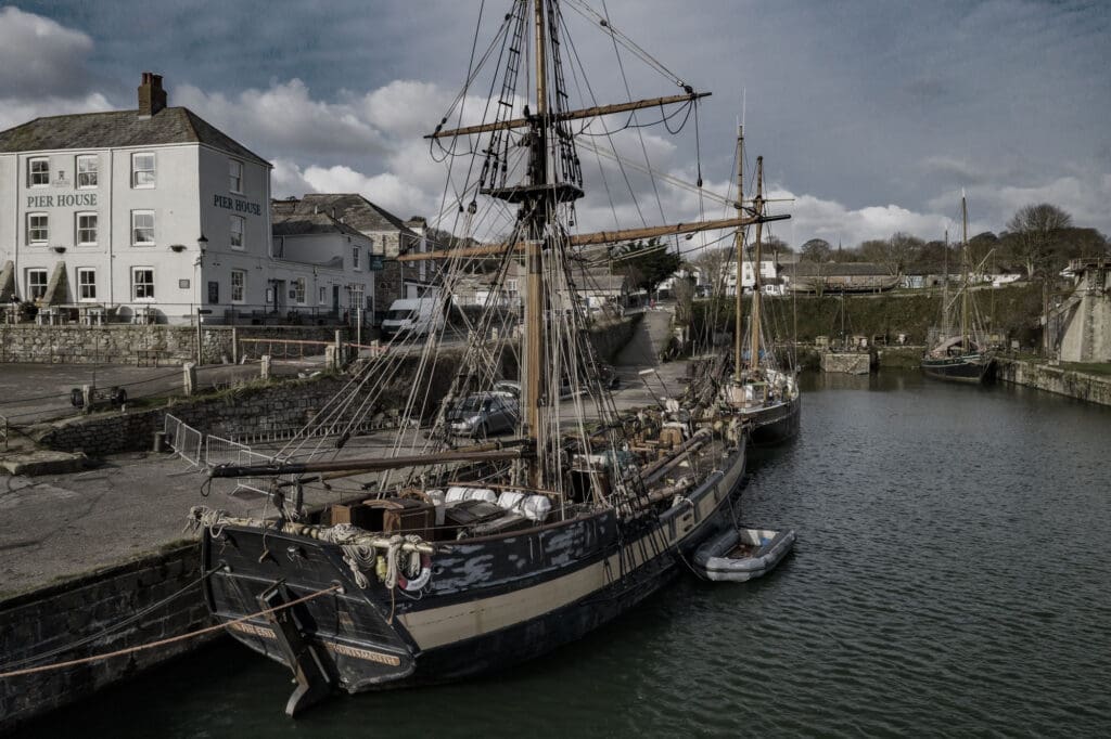
The final stretch involves a descent into the picturesque harbour village of Boscastle. The path can be steep and uneven in places, so take your time.
Google Map of the route: https://maps.app.goo.gl/JpDcCri46RfDmYSPA