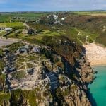
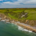
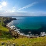
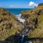
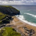
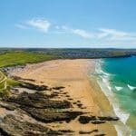
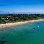
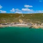
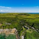
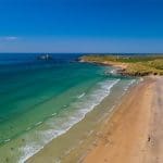
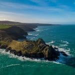
Rame Head is popular area for walkers, providing stunning views over the open sea and in both directions along the south coast.
Rame Head is a popular area for walkers, providing stunning views over the open sea and in both directions along the coast. A circular walk takes you from Cawsand to Penlee Battery and onto Rame Head itself before looping back down to Cawsand through the hamlet of Wiggle.
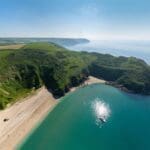
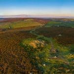
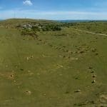
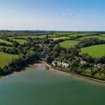
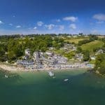
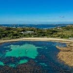
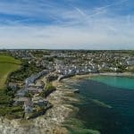
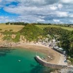
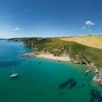
The sheltered valley behind the Rame headland forms an intimate and enclosed setting for Cawsand and Kingsand.
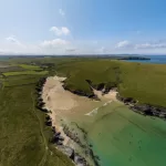
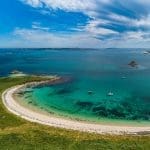
The area is perfect for hiking, birdwatching, and exploring historical sites. The South West Coast Path runs through Rame Head, providing scenic walks with breathtaking vistas. The ancient chapel atop the headland adds a touch of historical intrigue to this natural wonder.
Get full 7-day weather and tide data for each location on our new 360 Cornwall App
- Hazard: Deep Water
- Limited access for wheelchairs
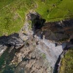
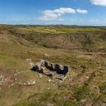
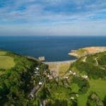
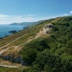
History of Rame Head
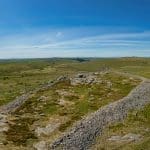
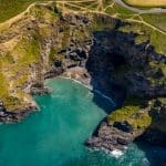
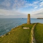
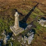
Rame Head has a deep history that dates back to prehistoric times. The headland’s strategic location made it an important lookout point throughout history. The ancient chapel of St. Michael, perched on the summit, is believed to have been built in the 14th century on the site of an earlier Celtic hermitage. This chapel served as a navigational aid for sailors and a place of worship for locals.
In addition to its religious significance, Rame Head played a crucial role in military history. The headland was used as a lookout during both World Wars, and its vantage point provided strategic views over the English Channel. Evidence of these military installations can still be seen today, adding to the historical layers of the site.
The surrounding area of Rame Head is rich in archaeological sites, including ancient field systems and burial mounds, reflecting its long history of human settlement and usage.
Travel / Parking information for Rame Head
Directions to Rame Head
From the A30, take the exit onto the A38 towards Plymouth. Cross the Tamar Bridge into Cornwall and continue on the A38 until you reach Trerulefoot. From there, follow signs for the A374 towards Torpoint. Continue on the A374 and then take the B3247 towards Millbrook. Follow signs for Rame Head. The route will lead you through scenic countryside and coastal roads to the headland.
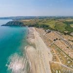
Parking for Rame Head
Parking at Rame Head is available at a small car park near the headland. Due to limited spaces, it’s advisable to arrive early, especially during peak times. Additional parking can be found in nearby villages such as Kingsand and Cawsand, with a longer but scenic walk to the headland. Please adhere to local parking regulations and be considerate of residents and other visitors when parking.